Pescadero State Beach
Looking for spectacular wildlife, natural beauty, and a great variety of terrain? A trip to Pescadero State Beach on any day of the year will not disappoint. I recently visited on a blustery winter day threatened with rain and there was plenty to see and do. All photos were taken on January 19, 2024.
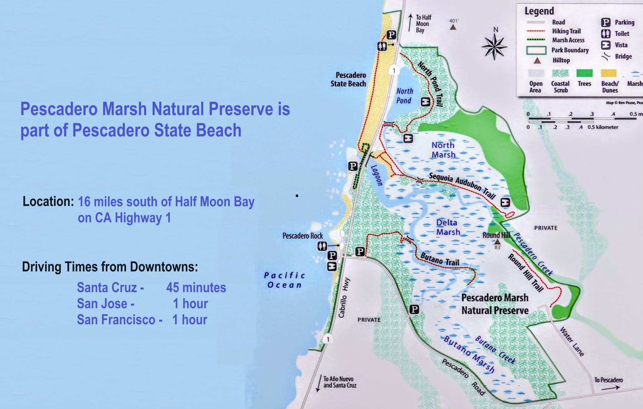
This nearly 2-mile beachfront consists of a broad sandy beach north of the creek bridge, and fascinating tidepools, dramatic shoals, and rock formations to the south. There are parking lots on at the north, central and south ends of the park. Pescadero Marsh Natural Preserve is a part of Pescadero State Beach. The 235-acre marsh, nourished by Butano and Pescadero Creeks, is across California Highway 1 from the beach. (See trail map below.)


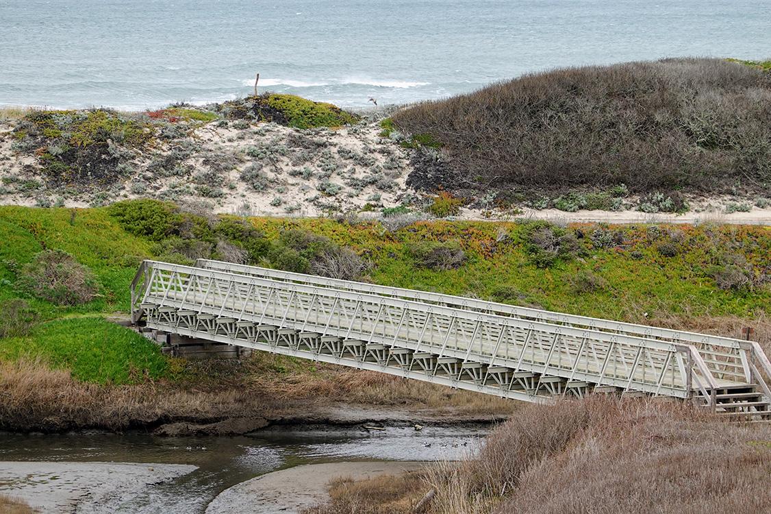
Pedestrian Footbridge
A footbridge funded by your support of CSPA connects Pescadero State Beach with Pescadero Marsh Natural Preserve. Beneath it runs Pescadero Creek, refuge to a rich array of wildlife. On this day, American coot and bufflehead sheltered below. Steelhead lay their eggs in the freshwater of the upper creek and return to the sea in the fall. A salmon-like fish, they are a trout because they live after spawning.
Pescadero Marsh Natural Preserve
The 235-acre Pescadero Marsh Natural Preserve, a part of Pescadero State Beach, lies on the eastern side of Highway 1 and surrounds the confluence of the Butano and Pescadero Creeks. It is the only extensive wetland along the coast of the San Francisco Peninsula.
 Trout Ponds. You may see bukllfrogs. Directions: E on Pescadero Crk Rd 1.7 mi., L on Water Lane to the end. Trail is on R.")


, and a female mallard (brown) shared the creek.")
 The reefs reveal all manner of clinging sea stars, crabs, and sea life.")
For more information about this state park, please click the links below.
CSPA Pescadero State Beach Page
State Parks Pescadero State Beach Page
CSPA Pescadero Marsh Natural Preserve Page